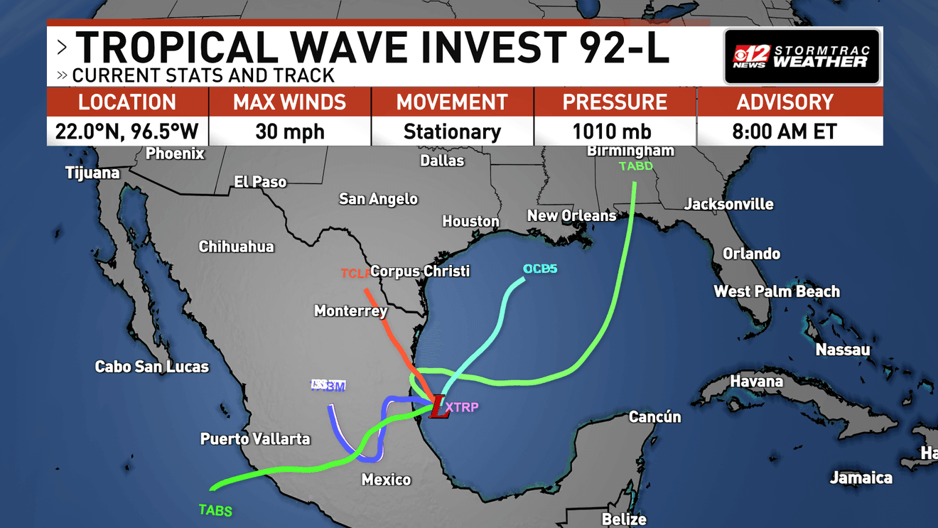
Investigation of Invest 92-L in the Gulf of Mexico
Location: Southwestern Gulf of Mexico, near the Bay of Campeche
Current Status: A broad trough of low pressure with disorganized showers and thunderstorms. No well-defined center of circulation yet.
Development Potential
- Chance of Development:
- 60% within the next 48 hours
- 80% likelihood later this week
- Expected Movement: Drifting eastward across the southern Gulf before turning northward towards the northern Gulf Coast.
Potential Impacts
- Heavy rain, gusty winds, and rough marine conditions may affect parts of the Gulf Coast later this week.
- Residents from northern Gulf Coast areas to Texas and Louisiana should stay updated as the situation evolves.
- No imminent threat to South Florida, but caution is advised due to the active hurricane season.
Key Notes
- October remains a period with a history of strong tropical system formations.
- The upcoming days will be crucial in determining if Invest 92-L develops into a named storm, potentially becoming “Isaias”.

Image Caption: Spaghetti plots show uncertainty, but a general consensus suggests the system may track into the northern Gulf.

Image Caption: Strong tropical systems can form in October.

Image Caption: The next named storm this season would be Isaias.