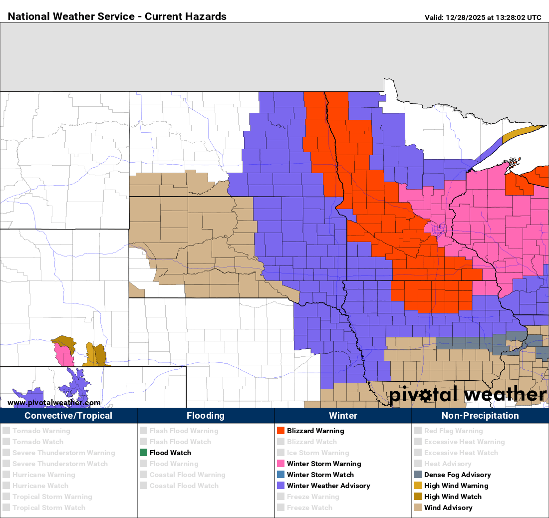
Major Winter Storm Alert for Minnesota and Wisconsin
A significant winter storm is forecasted to impact Minnesota and Wisconsin, creating dangerous, potentially life-threatening travel conditions from today through early Monday morning.
Storm Overview
A powerful low-pressure system will move from the central Plains into the Great Lakes, bringing heavy snowfall and strong winds to much of the Upper Midwest.
Timing and Snow Accumulation
- Snowfall will start across western Minnesota and move east by Sunday morning, expected to reach the Twin Cities between 9 and 10 a.m. and western Wisconsin by early afternoon.
- Initial snow rates may reach up to 1 inch per hour, leading to reduced visibility and hazardous travel.
- Total snowfall:
- 6-10 inches expected across central and eastern Minnesota and western Wisconsin.
- 1-5 inches in northern and southwestern Minnesota.
- 4-6 inches in areas under blizzard warnings.
Warnings and Advisories
- Blizzard Warning: In effect for western, central, and southern Minnesota due to the combination of snow and powerful winds.
- Winter Storm Warning: For east-central Minnesota (including the Twin Cities area) and western Wisconsin, where heavier snowfall and whiteout conditions are anticipated.
- Winter Weather Advisory: For areas adjacent to the blizzard warning, where lower snowfall amounts may still lead to hazardous conditions due to blowing snow.
Wind and Temperature
- Wind Sustained at 30-35 mph with gusts reaching 50-55 mph across western, central, and southern Minnesota. This will cause significant blowing and drifting snow, resulting in near-zero visibility in open areas.
- Following the cold front, temperatures are expected to drop 20-30 degrees, leading to possible flash freezes on previously wet surfaces.
Stay safe and make sure to check weather updates regularly!