Mapping Planetary Surfaces: A 3D Challenge
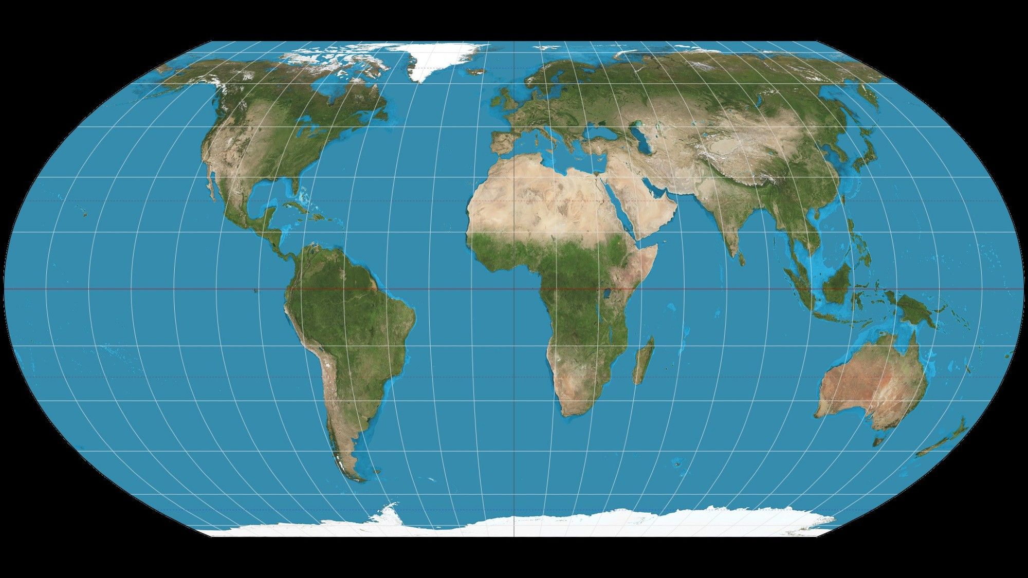
Mapping planetary surfaces presents an intricate challenge due to their three-dimensional nature. This is particularly true for Earth, where our perception often simplifies the complex curvature into a flat representation. Cartographers struggle with creating accurate two-dimensional maps like the Mercator projection and the newly favored Equal Earth projection.
The Art of Projection
Corey Fortezzo, a geologist involved with NASA’s planetary mapping, explains that maps can tell a story, but that story might not always align with reality. Flattening a 3D surface into 2D entails various distortions, affecting area, shape, distance, and direction. Each projection sacrifices certain aspects for others, and the choice of which projection to use depends on the map’s intended purpose.
The Mercator projection, for example, has long been favored for navigation because it preserves angles, making it useful for sailors. However, it distorts the size of landmasses, leading to misconceptions about relative sizes (such as Greenland appearing larger than South America).
The Shift to Equal Earth
As the purpose of world maps evolves from navigation to understanding global dynamics, there’s increasing support for projections like the Equal Earth, which maintains area accuracy at the expense of angular accuracy. This makes it a more suitable choice for educational settings, allowing a more accurate representation of countries and continents.
Extending Mapping Beyond Earth
The tradition of mapping extends beyond Earth, tracing back to the early 17th century with the first known moon map. Unlike Earth, extraterrestrial mapping has primarily relied on remote imaging technology. This data comes from spacecraft and telescopes, leading to a “stitched quilt” appearance where curved images must fit together seamlessly.
Each celestial body introduces its own unique challenges— including variations in shape and the need for unique definitions of zero degrees longitude. For instance, while mapping Mars or the dwarf planet Ceres, scientists find the absence of Earth’s diverse geological features simplifies their work.
Future Challenges and Possibilities
With initiatives like NASA’s Artemis program, focused on new lunar landing sites, the mapping needs will become increasingly complex. The shift from equatorial landings during the Apollo program to potential sites at the lunar south pole exemplifies how new missions will challenge existing projection techniques and frameworks.
In conclusion, mapping planetary surfaces—be it Earth or distant moons—remains a dynamic field fraught with challenges but also opportunities for innovation, as scientists seek to navigate the complexities of both terrestrial and extraterrestrial landscapes.