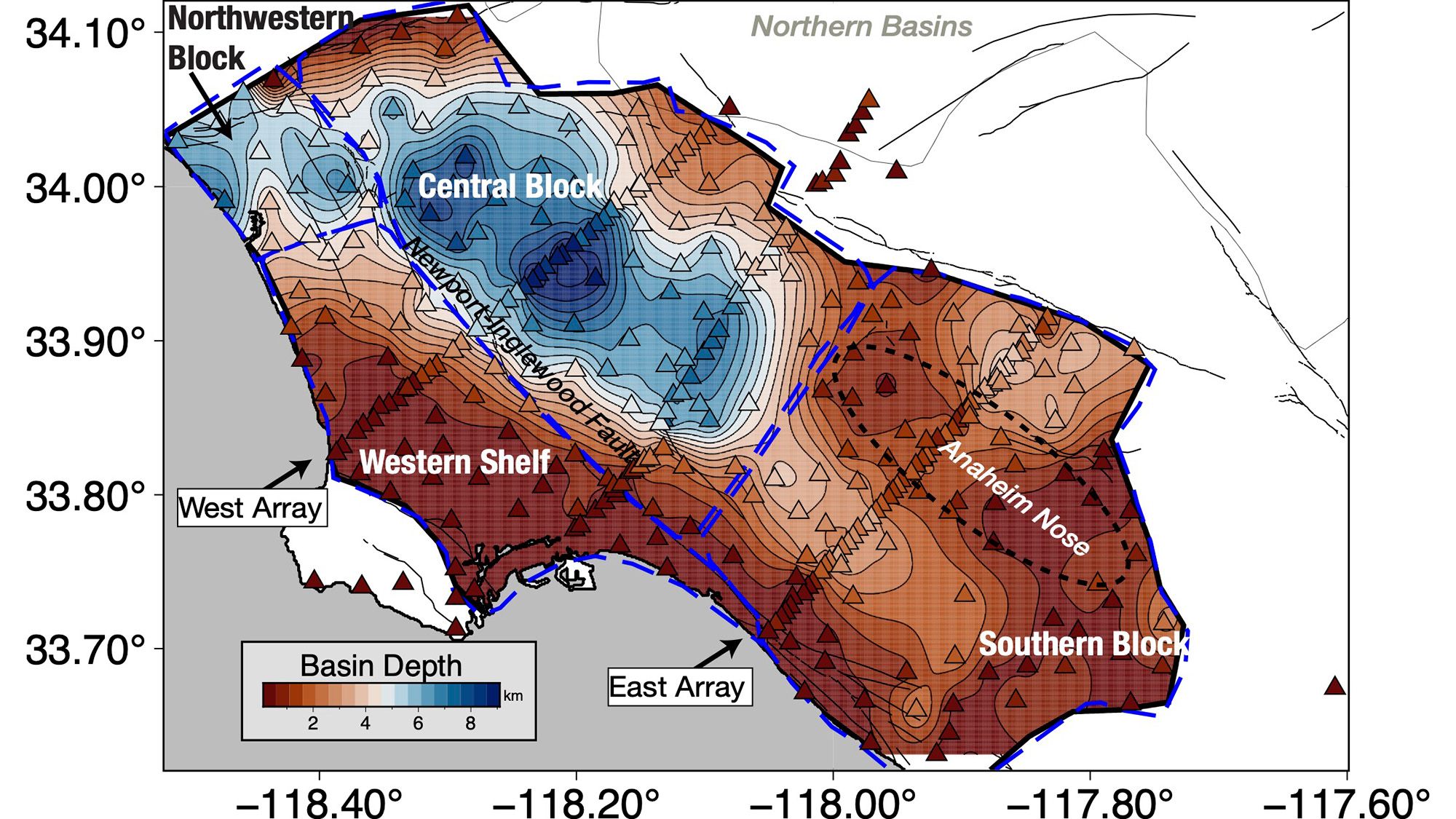
Scientists have developed a new, detailed 3D model of the Los Angeles basin, revealing that downtown LA is supported by up to 6.2 miles (10 kilometers) of sediment. This finding is crucial as it suggests that seismic waves from earthquakes may be amplified due to the sediment’s characteristics.
The improved understanding comes from data collected from 273 temporary seismic stations that detected earthquake waves from distant quakes. These waves enabled researchers to create a precise map of the subsurface.
This model highlights that the deepest sediments are under downtown LA, which could lead to stronger shaking during an earthquake. The edges of the basin, however, contain less sediment, creating a complex interaction with seismic waves.
By understanding the basin’s structure, scientists can better predict how different areas might respond to seismic events, important for future construction and safety measures.