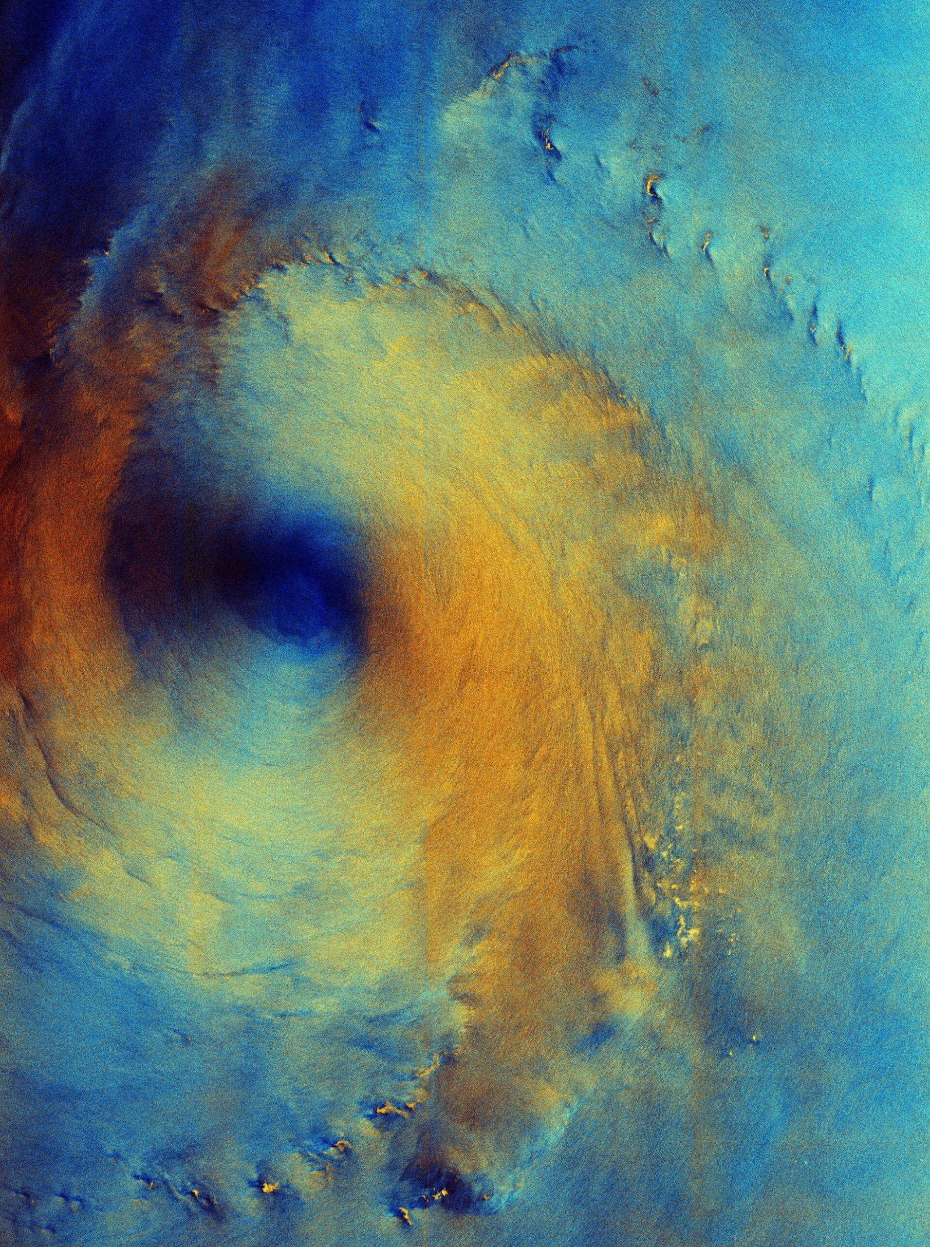
This text describes a false-color radar image of Typhoon Surigae, captured by the Copernicus Sentinel-1 satellite on September 28, 2026. The image provides a unique view of the sea surface beneath the storm clouds, showcasing the effects of strong winds as the typhoon passed over the Philippine Sea, about 200 km south of Shikoku, Japan.
Key Points:
- Observations: The image reveals calm seas at the eye of the storm (dark blue) and rough ocean conditions (orange-yellow ring) where strong winds are present.
- Radar Technology: The colorful representation comes from using two different radar polarizations, reflecting varying sea and wind conditions.
- Storm Details: At the time of the image, Typhoon Surigae exhibited maximum gusts of 240 km/h and wave heights up to 7 m. It has since weakened to a tropical depression with winds of 55 km/h.
- Misleading features: Bright yellow flecks in the image, mistaken for small islands, likely indicate areas with concentrated wind and rain instead of land masses.
The analysis of such images is crucial for understanding storm dynamics and predicting weather conditions.