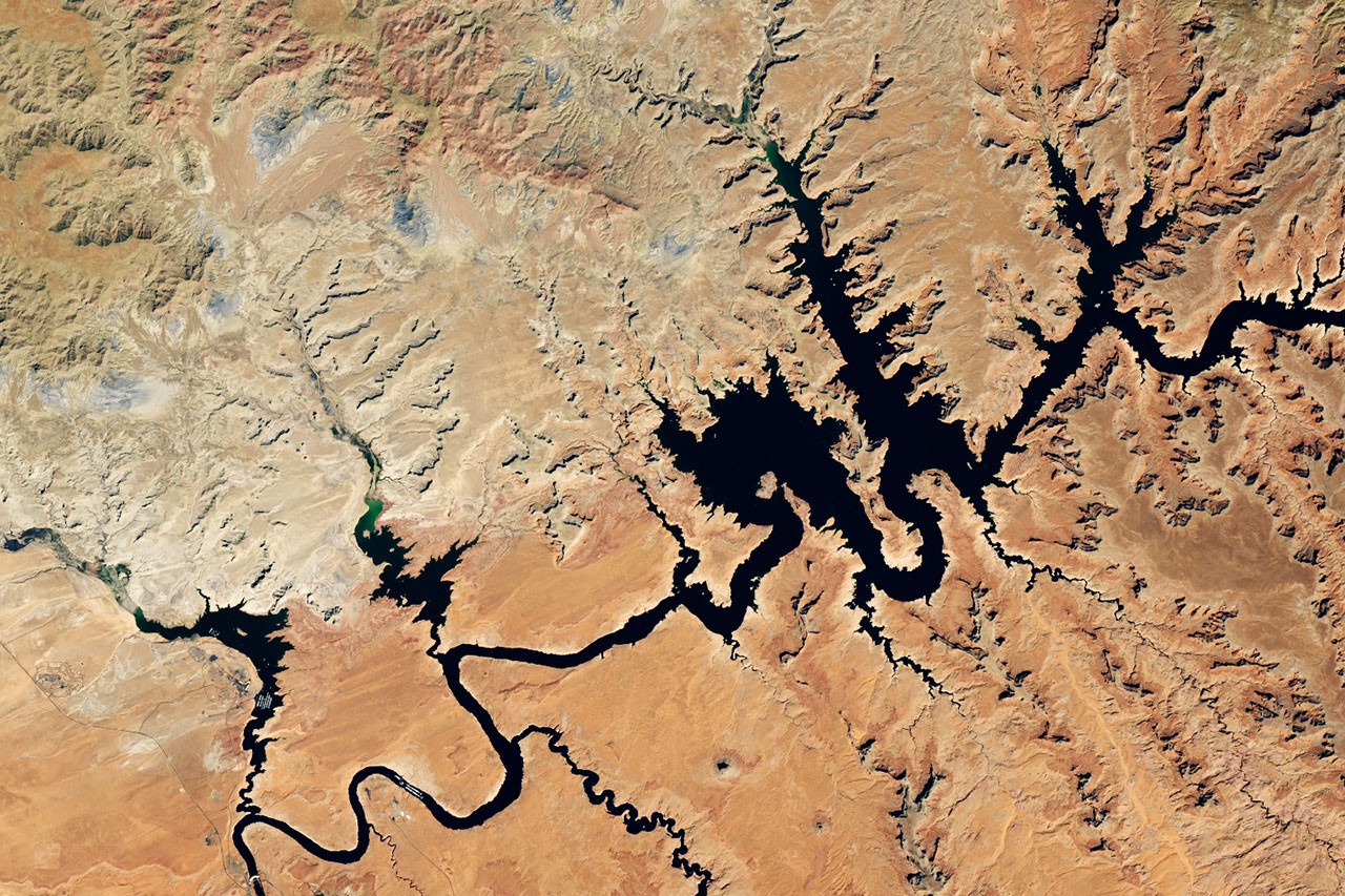
Overview: Lake Powell’s Record Low Levels
In the winter of 2025-2026, the Upper Colorado Basin experienced a significantly low mountain snowpack, leading to a dramatic reduction in water levels at Lake Powell by summer. By late August and early September 2026, Lake Powell hit record low levels following a decline in seasonal snowmelt.
Historical Context
- Images Comparison: A comparison of images from September 1, 2017, and September 10, 2026, shows the stark contrast in water levels. In 2026, the water level was recorded at 3,517.24 feet, dipping below the previous record low of 3,519.92 feet, set on April 13, 2023.
Importance of the Colorado River
- Water Supply: The Colorado River is essential for providing water and hydroelectric power to over 40 million people, including major cities like Las Vegas, Los Angeles, and San Diego. It also irrigates approximately 5 million acres of farmland in the Southwest.
Contributing Factors
- Arid Conditions: Much of the Colorado Basin is classified as arid or semi-arid, depending heavily on snowmelt for its water supply. The winter of 2025-2026 witnessed a significant snow drought, contributing to the ongoing megadrought affecting the region.
Management Actions
- USBR Interventions: In April 2026, the U.S. Bureau of Reclamation (USBR) initiated measures to stabilize Lake Powell to prevent it from dropping below levels needed for hydropower production. Actions included:
- Releasing water from the Flaming Gorge Reservoir.
- Reducing outflows from Lake Powell to Lake Mead.
- Canceling a controlled flood intended to support fish habitat.
Tools and Monitoring
- Drought Monitoring: Various NASA-funded initiatives are being utilized to monitor drought conditions and inform decision-making:
- WLDAS Dashboard: Delivers real-time soil moisture, snow water equivalent, and evapotranspiration visualizations.
- Drought Severity Evaluation Tool: Aids in monitoring localized drought conditions, developed in collaboration with the Navajo Nation.
- Colorado River Integrated Assessment Tool: Consolidates satellite-validated data for improved modeling of hydrological conditions across the basin.
Conclusion
The ongoing drought conditions in the Southwest have significant implications for water resources management, necessitating innovative tools and proactive measures to ensure the sustainability of vital water supplies like Lake Powell.
References
- NASA Earth Observatory Articles
- U.S. Bureau of Reclamation News Releases
- Scientific analyses on drought impacts and hydropower management
Images and additional data can be accessed through NASA Earth Observatory and the U.S. Geological Survey.