Quick Facts About Lake Pueyrredón and Lake Posadas
-
Where is it?
Lake Pueyrredón and Lake Posadas, Argentina
Coordinates: (-47.41961002, -71.87622200) -
What’s in the photo?
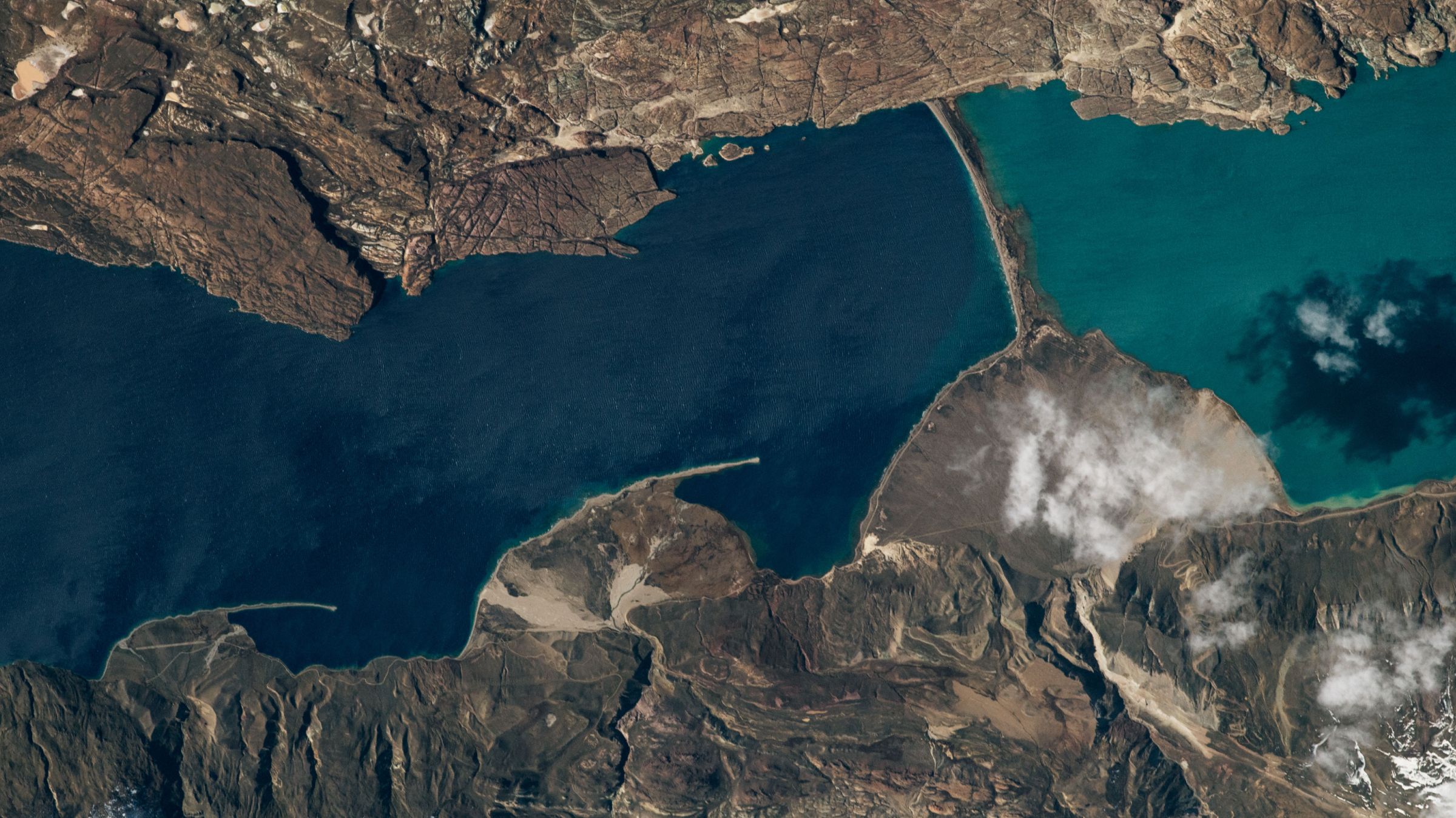
The point where two lakes with different colors meet. -
Who took the photo?
An unnamed astronaut on board the International Space Station. -
When was it taken?
September 15, 2020.
Description
This striking photo captures the juncture of two distinct bodies of water: Lake Pueyrredón and Lake Posadas. Lake Pueyrredón, on the left, is part of a glacial lake system that extends about 40 miles (65 km), with the Chilean half known as Lake Cochrane (not shown). Its deep blue color, arising from depths of up to 1,600 feet (500 meters), is evident from above.
Thousands of years ago, sediment accumulation created a barrier, leading to the formation of Lake Posadas, which is relatively shallower and exhibits a lighter teal color due to higher sediment influx from nearby rivers. This phenomenon results in the two lakes being visually distinct.
Geological Features
-
Sediment Barriers:
The southern section of Lake Pueyrredón holds sediment barriers that led to the emergence of Lake Posadas. -
Deltas:
The rivers surrounding Lake Pueyrredón have formed fan-shaped delta landforms along its western shore, with increased sediment deposition contributing to the lake’s landscape. -
Moraines:
The land strip separating the two lakes is likely a moraine—a formation created by glacial activities.
Recreation and Tourism
The area is popular for various outdoor activities, including camping, hiking, fishing, and kayaking, despite its largely uninhabited environment. Visitors can spot unique geological features like rocky arches in Lake Posadas and enjoy the picturesque views.
Additional Features
-
Ice Age History:
These lakes sit within a valley sculpted by an extensive ice sheet, remnants of which lie in northern Patagonia. -
Unique Landscapes:
Patagonia showcases many valleys and fjords shaped by glacial processes, adding to the region’s ecological and geological significance.
Feel free to explore the lakes and their surrounding natural wonders through various activities or virtually via satellite imagery!