Current Weather Update: Tropical Development in the Atlantic
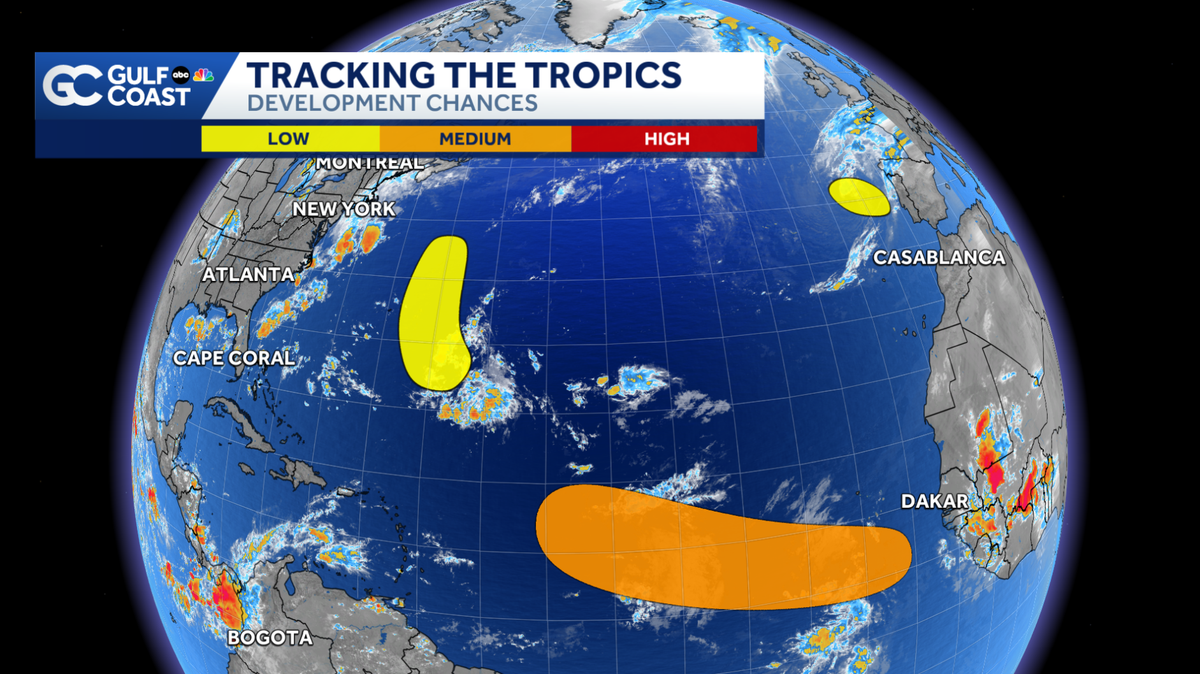
Invest 95L
- Location: A weak area of low pressure located a few hundred miles east-southeast of Bermuda.
- Development Probability:
- 20% chance of tropical development over the next two days.
- 30% chance over the next week.
- Movement: Drifting west-southwest but expected to turn north early next week. No direct threat to Florida anticipated.
Areas of Interest for Tropical Development
1. Eastern Atlantic
- Description: A tropical wave expected to emerge off the west coast of Africa.
- Development Odds: Medium chance of development over the next seven days.
- Movement: Anticipated to travel westward at 15-20 mph once reaching the ocean.
2. Northeastern Atlantic
- Description: A non-tropical low-pressure system in the northeastern Atlantic may gain tropical or subtropical characteristics.
- Development Odds:
- 20% chance over the next two days.
- 20% over the next week.
- Movement: Drifting east-southeast at 10 to 15 mph towards Portugal and northwest Spain, possibly bringing gusty winds and rough seas early next week.
FAQs
-
What is an “Invest”?
- The term “invest” stands for “area of investigation.” It indicates that the National Hurricane Center (NHC) is monitoring the system for potential development.
-
Upcoming Named Storms: If a storm develops from the current systems, the next name on the 2023 list is Dolly.
-
Seasonal Peak: The historic peak of hurricane season is September 10th. Stay tuned for continuous updates.
Stay Updated
- For real-time weather tracking, check out the Gulf Coast Live Radar.
- Watch the latest weather forecast videos on Gulf Coast News.
Make sure to follow us on social media for the latest updates and information.