National Hurricane Center Monitoring Three Disturbances
ORLANDO, Fla. — The National Hurricane Center (NHC) has flagged three areas of interest in the Atlantic as of its latest update:
-
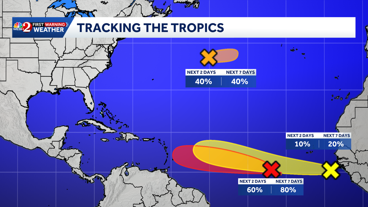
Invest 92-L
- A tropical wave approximately 700 miles southwest of the Cabo Verde Islands is showing organized showers and thunderstorms.
- Environmental conditions are favorable for development, with a likelihood of a tropical depression forming in the next couple of days as it moves westward.
- Formation chance:
- 48 hours: 60%
- 7 days: 80%
-
Invest 93-L
- Satellite images indicate a better-defined low-level circulation about 900 miles east-northeast of Bermuda.
- Further development is possible, and a short-lived tropical depression or storm may form in the next day as it moves eastward at around 20 mph.
- However, it is expected to reach cooler waters by Thursday, reducing its chances of formation.
- Formation chance:
- 48 hours: 40%
- 7 days: 40%
-
Disturbance 3
- A tropical wave near the coast of West Africa is generating disorganized showers and thunderstorms.
- Conditions are generally conducive for some development as it moves westward across the tropical Atlantic in the coming days.
- Formation chance:
- 48 hours: 10%
- 7 days: 20%
For ongoing updates, stay tuned to WESH 2 for the most accurate weather forecasts and alerts.
Tracking the Tropics
For the latest on tropical weather, download the WESH 2 News app for real-time alerts.