Agricultural grazing systems occupy approximately one quarter of the Earth’s terrestrial landscape. Accurately assessing feed availability is crucial for livestock productivity, land health, and long-term sustainability.
Traditionally, measuring pasture has involved manual sampling and field assessments, which can be labor-intensive, expensive, and difficult to scale effectively.
While satellite imagery and remote sensing technologies have expanded monitoring possibilities across vast regions, high-resolution ground-level digital photographs present a valuable opportunity to enhance the calibration of existing systems. These images can also uncover fine-scale attributes, such as species diversity and pasture quality.
In response, Australia’s national science agency, CSIRO, in collaboration with Google Australia and Meat & Livestock Australia Limited (MLA), initiated a global ‘Kaggle’ competition aimed at advancing the integration of artificial intelligence (AI) in agriculture.
The winners of the Image2Biomass Prediction Competition have been announced, with the Chinese team 卷不动了 claiming first place for their innovative method that adapted models to varying conditions, thus enhancing accuracy.
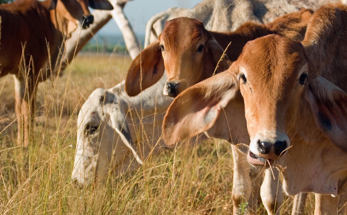
Participants were tasked with developing machine learning models to estimate pasture biomass directly from images captured across various Australian regions, seasons, and pasture types.
The successful teams showcased that advanced models can reliably extract significant information from images, such as the quantity of plant matter available for livestock, including grass and other vegetation. This capability persists even in the face of fluctuating conditions.
This approach marks a shift from broad monitoring techniques to targeted, site-specific management that accurately identifies where fertilizers or other interventions are necessary.
With a total prize pool of US$75,000, the competition attracted nearly 100,000 model submissions from around 14,000 participants across 109 countries, indicating robust global interest in leveraging specialized data science to tackle real-world agricultural issues.
Dr. Dadong Wang, Senior Principal Research Scientist at CSIRO, remarked that the results represent a significant advancement in agricultural research, environmental monitoring, and sustainable land management.
“Participants rapidly tested a diverse range of approaches and refined their models in various ways, leading to significant improvements in the accuracy of feed level predictions across different regions, seasons, and pasture conditions,” Dr. Wang stated.
“The winning solutions demonstrated that reliable outcomes can be achieved with relatively small datasets, making these tools practical for real-world farming environments where conditions are constantly in flux.”
Instead of tailoring solutions for individual sites or seasons, top-performing teams concentrated on enabling systems to perform reliably across different environments by recognizing pasture patterns and capturing detailed botanical elements in the images, such as wilting grass or tiny clover leaves. This technique ensured that predictions remained dependable despite shifting landscapes, weather conditions, and variations in pasture composition.
Michael Lee, Group Manager – Science and Innovation at MLA, noted that these results highlight growing opportunities to provide producers with enhanced insights.
“Understanding how much feed is available and its composition is essential for effective grazing management,” Mr. Lee said. “The methodologies showcased during this competition pave the way for future tools that could lessen dependence on manual measurements and offer producers quicker, more comprehensive insights to guide daily decisions.”
Scott Riddle, Partnerships Principal at Google Australia, expressed that the competition highlighted the importance of connecting research, industry, and the global technology sector.
“By uniting CSIRO’s scientific expertise, MLA’s industry insights, and the global Kaggle community, this challenge illustrates how partnerships can effectively bridge the divide between research and practical applications,” Mr. Riddle commented.

CSIRO will meticulously analyze the winning methods to guide future research and development efforts while continuing collaboration with industry partners to explore ways to transform these promising techniques into practical, scalable tools for pasture measurement.
This initiative has received support from FrontierSI, previously known as the Cooperative Research Centre for Spatial Information.
The winning teams of the Image2Biomass Prediction Competition include:
- Team 卷不动了 from China adopted a unique strategy by treating available feed as a counting problem instead of a simple estimate, allowing models to adapt to new conditions and enhance accuracy on previously unseen data.
- Team dino series from Vietnam focused on identifying where feed appears within an image, estimating spatial distribution, and utilizing simulated environmental variations to bolster performance.
- Team embee from the United States emphasized robustness by integrating multiple models into a cohesive system, minimizing overfitting and delivering more consistent outcomes across a highly variable dataset.