Invest 90-L Tagged Off the Coast of Africa
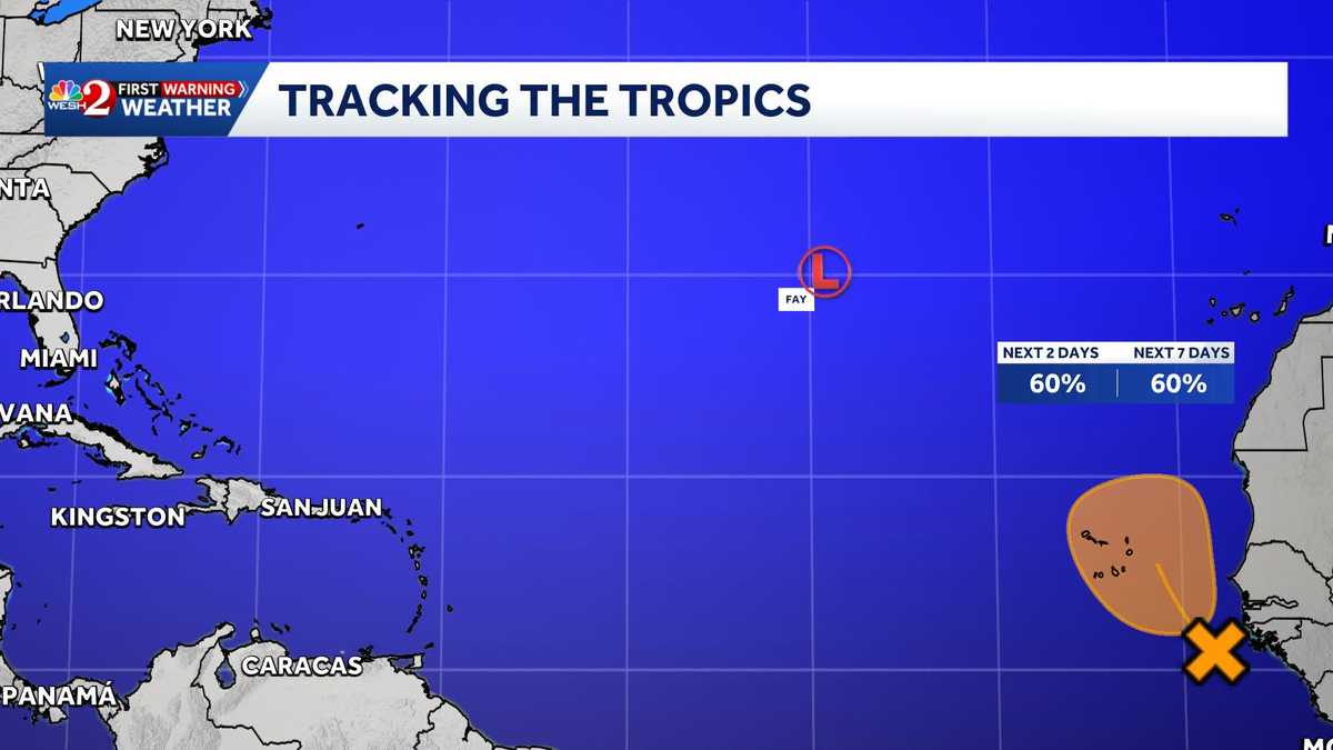
A tropical wave has been designated as Invest 90-L by the National Hurricane Center.
Current Status:
- Location: A few hundred miles southeast of the Cabo Verde Islands
- Conditions: Accompanied by a large area of disorganized showers and thunderstorms.
The NHC’s latest update (8 p.m. Wednesday) indicates that:
- Invest 90-L could develop into a short-lived tropical depression as it moves northwestward to northward by Thursday or Friday.
- However, strong upper-level winds are expected to hinder further development by the weekend.
Formation Chances:
- Through 48 hours: 60%
- Through 7 days: 60%
Impact:
- Currently, the system does not pose a threat to Central Florida. However, residents in the Cabo Verde Islands should monitor its progress, as gusty winds and heavy rain are possible by Friday.
Resources for Hurricane Preparedness
- Hurricane Supplies
- Survival Guide
- Hurricane Season Special
- WESH Long-Range Forecast
- Hurricane Insurance
- Generator Setup
- Testing Chainsaws
- Post-Storm Resources
- Download WESH 2 App
Stay tuned to WESH 2 for the latest updates on this tropical wave and other weather alerts in Central Florida.