Saturday
Weather Summary
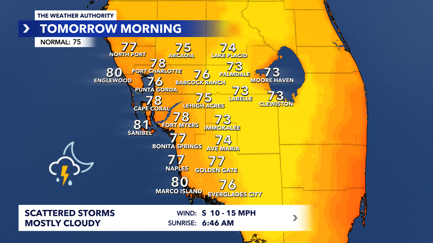
Showers and thunderstorms are expected to gradually lessen throughout the evening, although some heavy downpours may still occur before the activity dissipates overnight. Skies will remain mostly cloudy with warm, muggy conditions, and overnight lows will drop to the mid-70s.
Tropical Disturbance
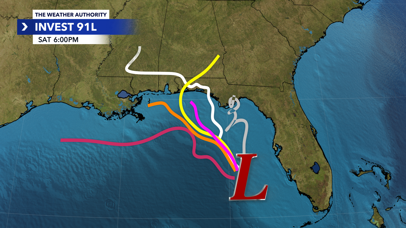
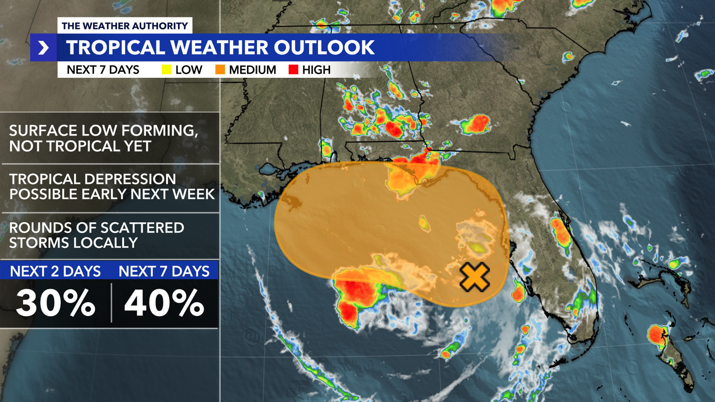
Meanwhile, a broad area of low pressure over the eastern Gulf has become more organized and is now designated as Invest 91L. Though it still lacks a well-defined center, satellite observations indicate a developing surface low. The National Hurricane Center notes that gradual development is possible, with the system potentially becoming a tropical depression in the coming days as it drifts north to north-northwest.
Regardless of its classification, Southwest Florida will continue to experience tropical downpours, gusty winds, and rough marine conditions through the weekend.
Sunday Outlook
Expected Conditions
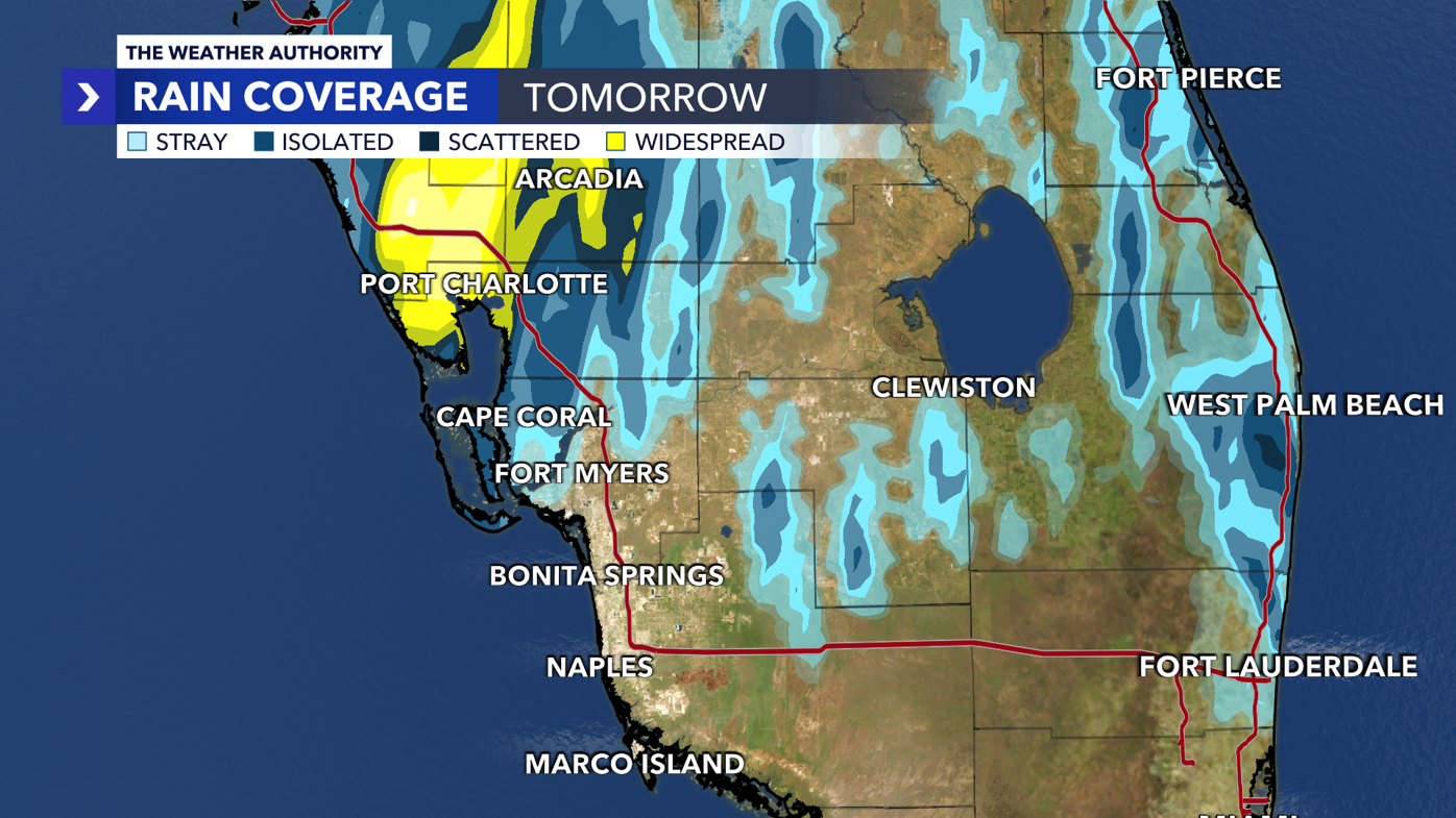
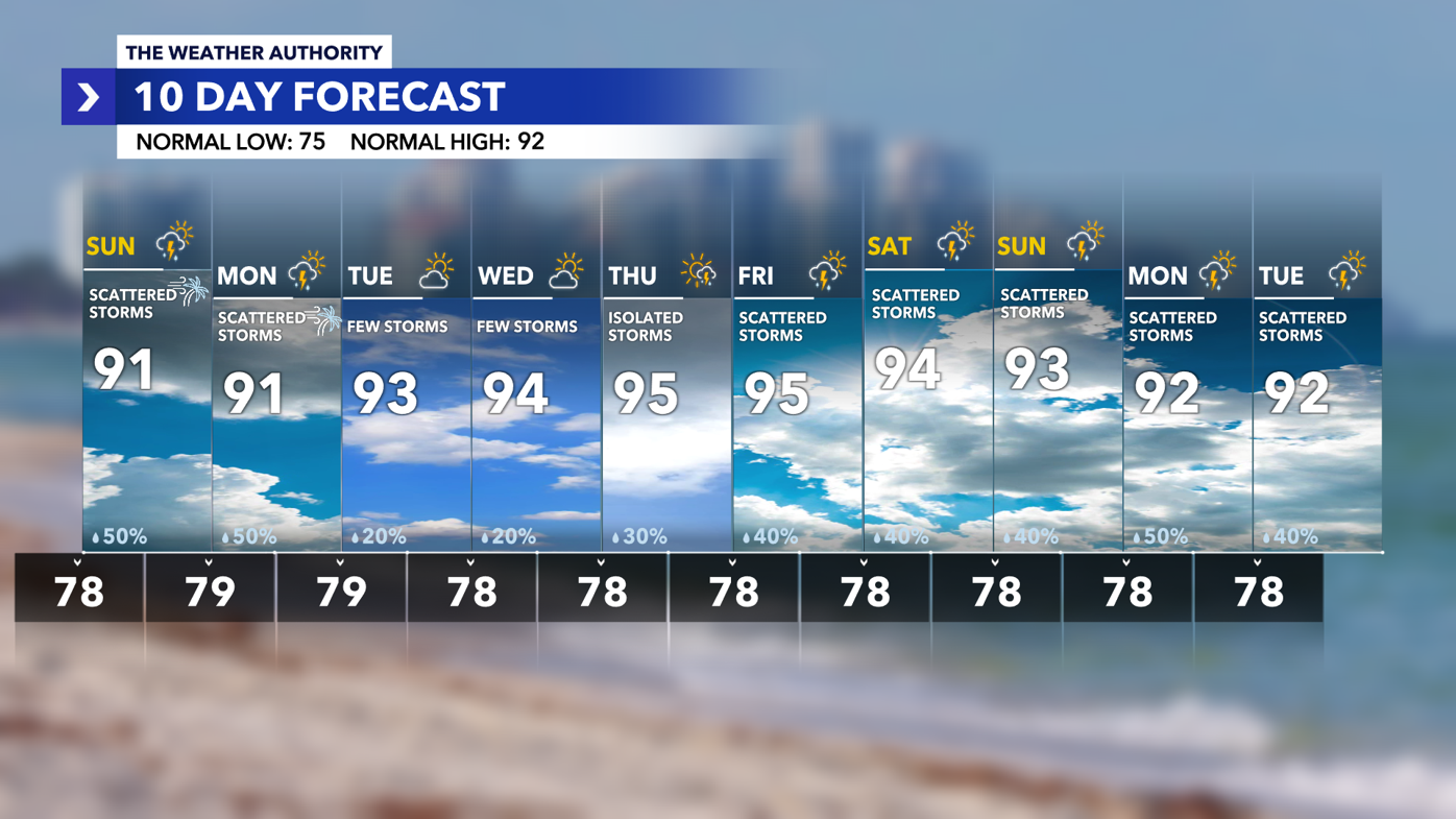
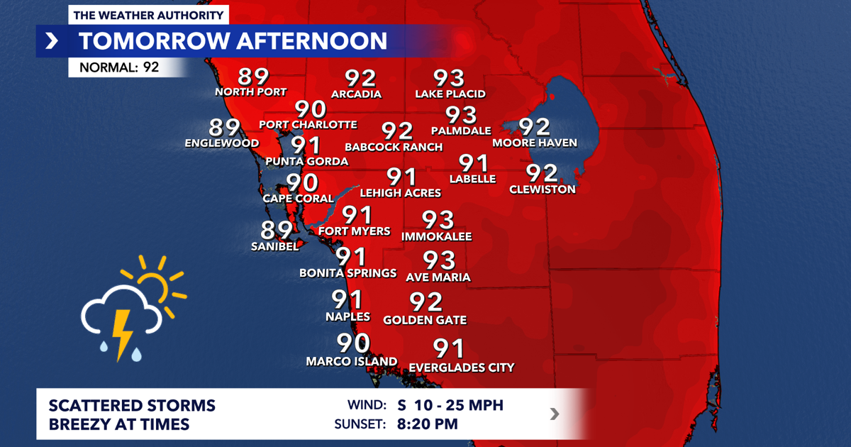
Similar weather is anticipated for Sunday, although rain coverage may decrease slightly as the disturbance shifts farther north. Scattered showers and storms will likely develop starting near the coast in the morning and then move inland by the afternoon. Highs are expected to approach seasonal averages in the lower 90s.
Looking Ahead
Monday & Beyond
Rain chances are expected to remain around 50% on Monday as Invest 91L moves further north towards the northern Gulf Coast. By mid-week, slightly drier air may filter into Southwest Florida, resulting in fewer afternoon storms and rising temperatures, reaching the mid-90s by Thursday and Friday.
Tropical Development
The National Hurricane Center has increased the chances for development of Invest 91L to 30% over the next 48 hours and 40% over the next week. Environmental conditions could support gradual development as the system moves slowly north in the eastern Gulf.
Impacts
For Southwest Florida, the main impacts will likely be heavy rainfall, scattered thunderstorms, gusty south winds, rough boating conditions, and an increased risk of rip currents. Further updates from the National Hurricane Center are expected.
Images